OpenLR™ is a standard used to handle map locations.
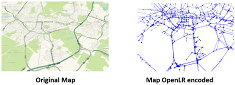
It is designed to transfer location information between different traffic management systems using dissimilar maps. The encoded locations are typically specific road stretches, lists of connected roads, point locations or areas.
OpenLR™ allows users to read data from Flows without knowing the internal network representation used by Flows.
In the KPI API context, a KPI result is associated to a specific location: a location is composed by several streets and every street is characterized by an OpenLR code.
KPI API endpoints return details for all locations for a given customer by adding the OpenLR codes attached to the street entities that are associated to a generic corridor.
Here is an example:
{
 "name": "giotestfinal",
 "entities": [
   {
     "strt": 84899,
     "fsnd": 96586,
     "openLrCode": "CwjonR3U/yKDBADPAMYiM+k=",
     "order": 0,
     "startProgressive": 0.66502345,
     "endProgressive": 1
   },
   {
     "strt": 84898,
     "fsnd": 88888,
     "openLrCode": "CwjonR3U/yKDBADPAMYicxbf",
     "order": 1,
     "startProgressive": 0,
     "endProgressive": 1
   },
   {
     "strt": 126146,
     "fsnd": 80148,
     "openLrCode": "CwjonR3U/yKDBADPAMYicyBm",
     "order": 2,
     "startProgressive": 0,
     "endProgressive": 1
   },
   {
     "strt": 136457,
     "fsnd": 126079,
     "openLrCode": "CwjonR3U/yKDBADPAMYic5kX",
     "order": 3,
     "startProgressive": 0,
     "endProgressive": 1
   },
   {
     "strt": 135697,
     "fsnd": 135178,
     "openLrCode": "CwjonR3U/yKDBADPAMYiU+g=",
     "order": 4,
     "startProgressive": 0,
     "endProgressive": 1
   },
   {
     "strt": 65935,
     "fsnd": 49646,
     "openLrCode": "Cwjo/h3VWyKDAgBjAFkiM5Y=",
     "order": 5,
     "startProgressive": 0,
     "endProgressive": 1
   },
   {
     "strt": 36182,
     "fsnd": 29518,
     "openLrCode": "Cwjo/h3VWyKDAgBjAFkiU2o=",
     "order": 6,
     "startProgressive": 0,
     "endProgressive": 0.5083329
   }
 ],
 "shape": "LINESTRING (12.5279 41.951363, 12.52796 41.95142, 12.52796 41.95142, 12.52804 41.95151, 12.52804 41.95151, 12.52903 41.95244, 12.52903 41.95244, 12.52966 41.95305, 12.52966 41.95305, 12.52985 41.95323, 12.52985 41.95323, 12.53026 41.9536, 12.53026 41.9536, 12.530555 41.953864)",
 "locationId": "833c5ead-3777-4a00-9d8b-87e1b41d1e7f",
 "locationType": "PATH"
}
As you can see, an OpenLR code is associated with each corridor street (locationType: PATH).